What is the impact of Local Climate on Building Design?
Project Location:
Simulation Scale:
Application:
Audience:
What is this graphic showing? Describe the different parts of the graphic and how it communicates the data.
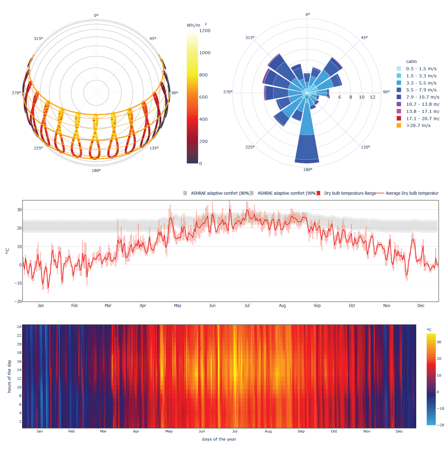
CBE Clima (https://clima.cbe.berkeley.edu/) is an open source web resource that allows easy access to ~30,000 freely available EPW weather files (and you can upload your own too!). CBE Clima creates high-quality, downloadable, interactive climate graphics for early stage climate analysis for the AEC industry and education community. Clima allows the user to interactively explore the data contained in EPW files and derived information (sucha s solar position and other psychrometric quantities) It enables the user to create, customize and download: - Climate Summary - Heating and cooling degree days - Monthly, daily and hourly visualizations for most variables in EPW files (and some more) - Spherical and Cartesian sun chrts with optional data overlay - Interactive and custmizable wind roses - Interactive and customizable psychrometric charts with frequncy and data overlay - Climate based natural ventilation potential - Universal Thermal Climate Index (UTCI) thermal stress and and Equivalent temperature under different scenarios - further data exploration tools - and more...
What was successful and/or unique about the graphic in how it communicates information?
CBE Clima (https://clima.cbe.berkeley.edu/) is a free and open source project. You can contribute to the source code on GitHub >> https://github.com/CenterForTheBuiltEnvironment/clima Or you can get in touch with us through this google form >> https://forms.gle/8idUDtmUJ4mFEt5M6
Is there anything else you would like to mention?
CBE Clima has been sponsored by the Center for te Built environment (https://cbe.berkeley.edu/) at UC Berkeley and created by Giovanni Betti, Federico Tartarini and Christine Nguyen with the support of Stefano Schiavon
Supplementary Graphics
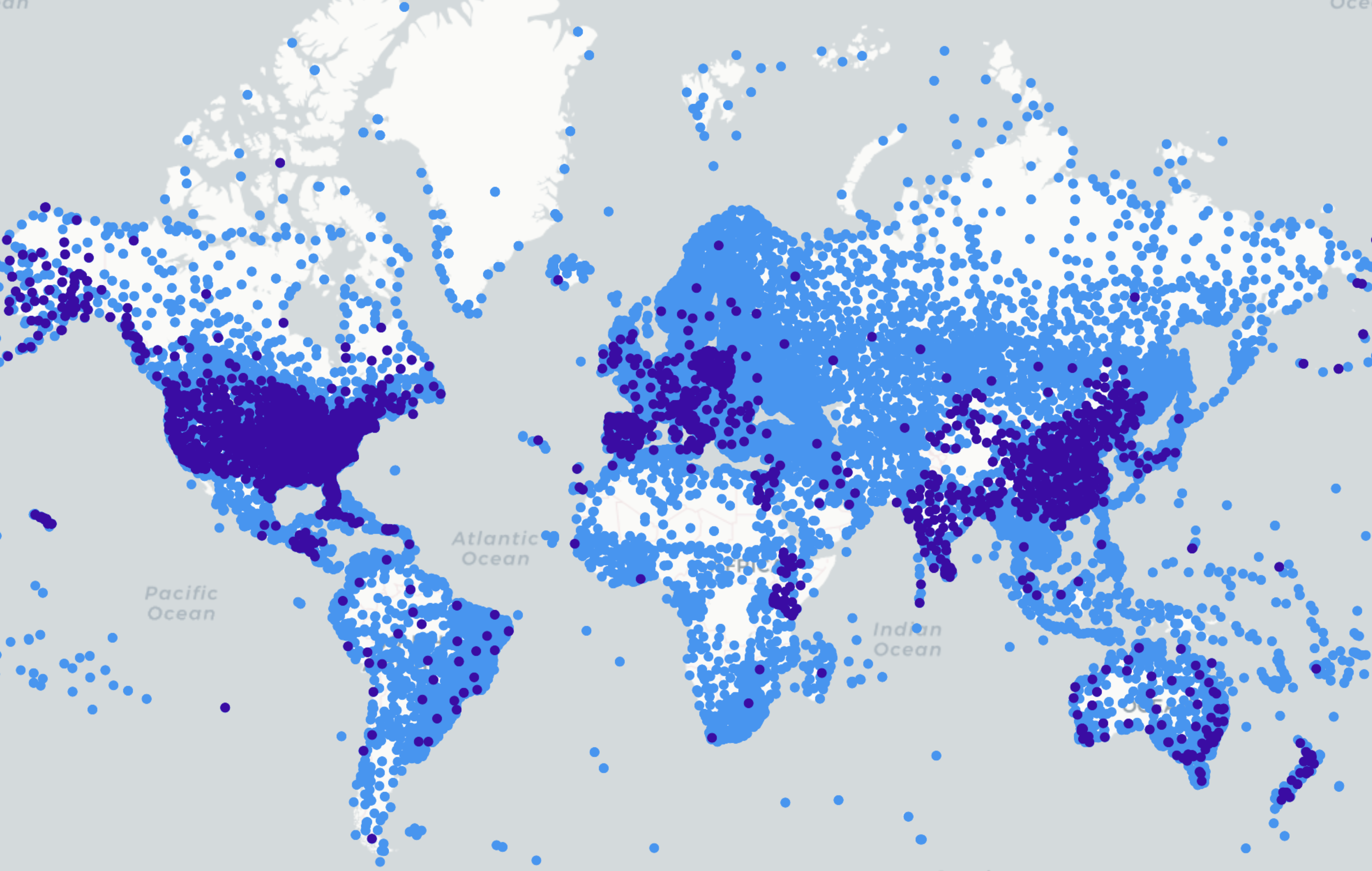
map of available weather files in Clima